
Lake Forest ZIP Code Coverage
Three practical ZIP areas appear in the verified Lake Forest coverage set, but they do not carry equal municipal meaning. 92630 is the core Lake Forest and former El Toro area, including the civic center and El Toro Library. 92610 serves Foothill Ranch and northeast Lake Forest development. 92679 covers Portola Hills and wider Trabuco Canyon postal geography, including some unincorporated canyon addresses. The postal name in the last column is a clue to delivery routing, not a legal finding about city limits.
| ZIP | Areas | Postal Name | Notes |
|---|---|---|---|
| 92630 | Core Lake Forest and former El Toro neighborhoods; civic center and El Toro Library | Lake Forest | Primary city ZIP; confirm the parcel and city line. |
| 92610 | Foothill Ranch and northeast Lake Forest development | Foothill Ranch | Foothill Ranch joined Lake Forest in 2000; older sources retain the name. |
| 92679 | Portola Hills, Trabuco Canyon postal geography, and nearby unincorporated canyon areas | Trabuco Canyon | Portola Hills is in Lake Forest, but the whole ZIP is not. |
The table is deliberately narrow. Research did not verify a Lake Forest-only unique or PO-box ZIP. Do not copy city population from ZIP coverage. Query USPS address by address when city name or delivery type matters. A sound ZIP code directory names the practical set without claiming one city owns every postal address.
92630 Keeps El Toro in the Search
92630 is the clearest core-city starting point. It covers central Lake Forest and former El Toro neighborhoods, and the civic center and El Toro Library sit within that postal context. El Toro Library's retained name is a useful reminder that postal and institutional labels can preserve an older place identity even after incorporation. A current address search can use Lake Forest, while older newspapers, directories, and permits may need El Toro.
That name bridge matters for a records question rather than a simple mail question. The city incorporated on December 20, 1991, so a pre-1991 reference may belong to county-era custody or use El Toro as the place term. A standardized address result does not rewrite an old index. Keep the current postal result, the historical name, and the parcel's APN as separate notes.
92610 Links Foothill Ranch to Lake Forest
92610 is the practical ZIP for Foothill Ranch and northeast Lake Forest development. Foothill Ranch was annexed to Lake Forest in 2000, yet the postal name remains important for catalogs, local reference sources, and historical searches. The same address can therefore be municipal Lake Forest, postal Foothill Ranch, and county-recorded in Orange County. Those are not conflicting results. They answer different questions.
For records before annexation, ask which office held the file when it was created. A permit or planning record from before 2000 may have originated with Orange County even if a current map places the parcel inside Lake Forest. The Foothill Ranch OCPL branch is a local reference access point, but library resources are research tools, not current resident rolls. Search both place terms when a name or address trail crosses the annexation date.
92679 Meets the Canyon Edge
92679 needs the most caution. Its postal geography includes Portola Hills and broader Trabuco Canyon areas. Portola Hills is within Lake Forest after the 2000 annexation, while other 92679 addresses may be in unincorporated canyon areas. A city label inferred from the ZIP can send a request to the wrong custodian, misread an election geography, or make a community name look like a boundary.
Use the Lake Forest City Maps and ArcGIS viewers and county parcel context to decide whether the situs is inside Lake Forest. Keep Trabuco Canyon as the postal name when USPS returns it, even if the parcel is Portola Hills. This is a useful myth check: a ZIP is a delivery route, not a municipal polygon. The address, APN, legal description, and jurisdiction need to agree before a ZIP result is treated as local evidence.
Lake Forest ZIP Code Record Search
The strongest ZIP-capable official people lead located in the research is California's unclaimed-property search. It is useful when a known name or property identifier needs a former city or ZIP check. It is not a resident roster, and it does not replace parcel or address verification. The search is free, but an old reported address can make the result a stale lead.
| Search field | Rule | What it does |
|---|---|---|
| Last or Business Name | Required unless Property ID is supplied | Starts the reported-property search |
| Property ID | Alternative required key | Goes straight to a reported property lead |
| First Name | Optional | Narrows a name match |
| City | Optional | Narrows the reported city |
| ZIP Code | Optional | Narrows the reported ZIP |
| Returned fields | Result display | Owner, reported city and ZIP, property type, holder, amount category, and property ID |
Because the output is tied to reported unclaimed property, it may reflect a former connection, not a current location. Read the reported city and ZIP as fields attached to that claim. For a current parcel question, use APN and situs with the Orange County Assessor property-information route, Tax Collector search, and GIS. If the hosted service lacks a needed field, use the Assessor public service counter. For a person's own election status, the California My Voter Status tool requires identity verification and does not open a ZIP browse. No verified assessor or voter mode returns every Lake Forest record by ZIP.
ZIP-by-ZIP Recipes for Lake Forest Records
Once a target ZIP is chosen, use a short chain that keeps postal, parcel, and people evidence distinct. The recipes below are deliberately different because the three practical ZIPs do not mean the same thing locally.
- 92630. Run USPS on the full address, confirm Lake Forest parcel geography in city GIS, then carry the APN into the Orange County Assessor, tax search, and RecorderWorks. If the source predates 1991, repeat the name search with El Toro.
- 92610. Keep Foothill Ranch as the postal and catalog term, check Lake Forest jurisdiction, then ask whether a pre-2000 permit belongs to county-era custody. Use the APN to connect the current parcel to any county record.
- 92679. First decide Portola Hills or unincorporated Trabuco Canyon, then route city records accordingly. Do not treat a name plus ZIP match as proof of residence; use a known property, court, archive, or other lawful record to support the claim.
After a ZIP has been narrowed to a specific street, the Lake Forest by-street directory can handle the address-keyed parcel sequence. Assessor, Tax, and GIS tools do not expose a verified open all-ZIP return in the research. RecorderWorks is a party and document index, not a ZIP roster. That limitation is part of the search recipe, not a missing step.
USPS Checks for a Lake Forest ZIP
USPS is the first stop when an address may be misspelled, assigned to a unit, or paired with the wrong postal city. The USPS ZIP lookup offers Find by Address plus city/state and ZIP modes. Find by Address uses street address, city, and state, with an optional apartment or unit. Its standardized result is the postal-format check. It does not decide whether a parcel is inside Lake Forest, and it does not identify residents.
The captured USPS city and state lookup shows the postal check that belongs before a parcel search.
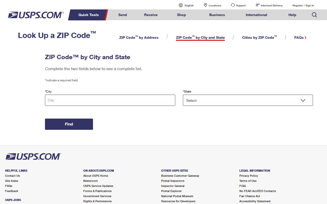
Keep the standardized postal result beside the municipal GIS result; the two systems answer different questions.
- Choose Find by Address when a full street location is available.
- Enter the street address, city, and state exactly as known, keeping the city field separate from the municipal question.
- Add the apartment or unit only when the address record supplies one.
- Save the returned postal city and ZIP as the standardized mailing result.
- Compare that result with the Lake Forest GIS situs and APN before opening property, deed, or historical records.
A city/state search is helpful when testing a postal place name, while a ZIP search is useful for checking the addresses associated with a code. Neither mode draws a city line. If USPS returns Trabuco Canyon, retain that result, then use GIS to decide if the situs is Portola Hills inside Lake Forest or an unincorporated canyon parcel. Store the query date because postal labels and live forms can change.
Lake Forest ZIP Boundaries and City Limits
ZIP boundaries and Lake Forest city limits overlap, but they are not the same map. 92630 is the primary city ZIP, yet postal edges still need a situs check. 92610 carries Foothill Ranch's postal identity after annexation. 92679 combines Portola Hills with broader Trabuco Canyon geography. A ZIP search can include outside-city parcels or miss a city-associated address using another postal name.
Three address fields keep the result honest. Situs is where the assessed parcel sits. Mailing address is where the owner or assessee receives a notice. Legal description is the land identity recorded by tract, lot, parcel map, or an older rancho description. A matching mailing address and situs can support an owner-occupancy hypothesis, but neither field lists every person at the property. The APN is the stable bridge for cross-checking, though parcel splits or combinations can change it.
The California voter-registration information page explains the broader election context behind a status check and its protected-data limits.
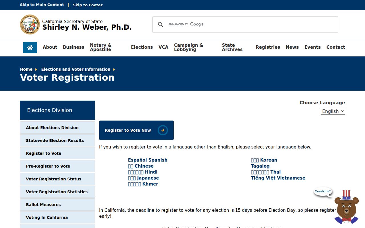
Use voter material only for the access purpose allowed by the election authority, and label the geography used.
Why ZIP Is Not a City Total
Postal counts and civic counts answer different questions. A ZIP is built around delivery routes. Census ZCTAs are statistical approximations, not USPS ZIP Codes, so a ZCTA total should not be presented as the number of Lake Forest residents. Research did not surface a verified per-ZIP population or registration total. The safer practice is to name the geography used, whether it is incorporated Lake Forest, a ZIP delivery area, or a Census ZCTA.
That distinction also limits people searches. The Assessor did not expose a verified free owner-name mode that returns all parcels under a ZIP. The voter-status tool is a private self-check, not open ZIP browsing. Qualified files are purpose-limited, and Safe at Home may suppress or substitute an address. Unclaimed property is the real ZIP-capable name search, but its report describes property leads. A ZIP code directory can organize routes and search choices without claiming to list every resident.
The Safe at Home program is a useful privacy boundary for ZIP research because a qualified participant may use a substitute mailing address.
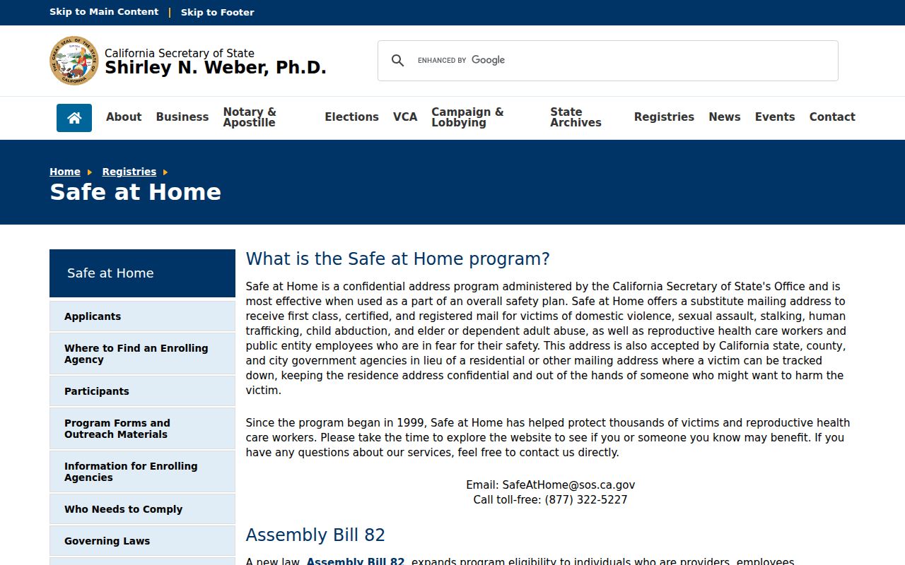
A substituted address should never be treated as a normal neighborhood or parcel result.
California voter-file rules add another boundary. Elections Code section 2194 limits access and use, so a ZIP code cannot be used as an open voter roster key.
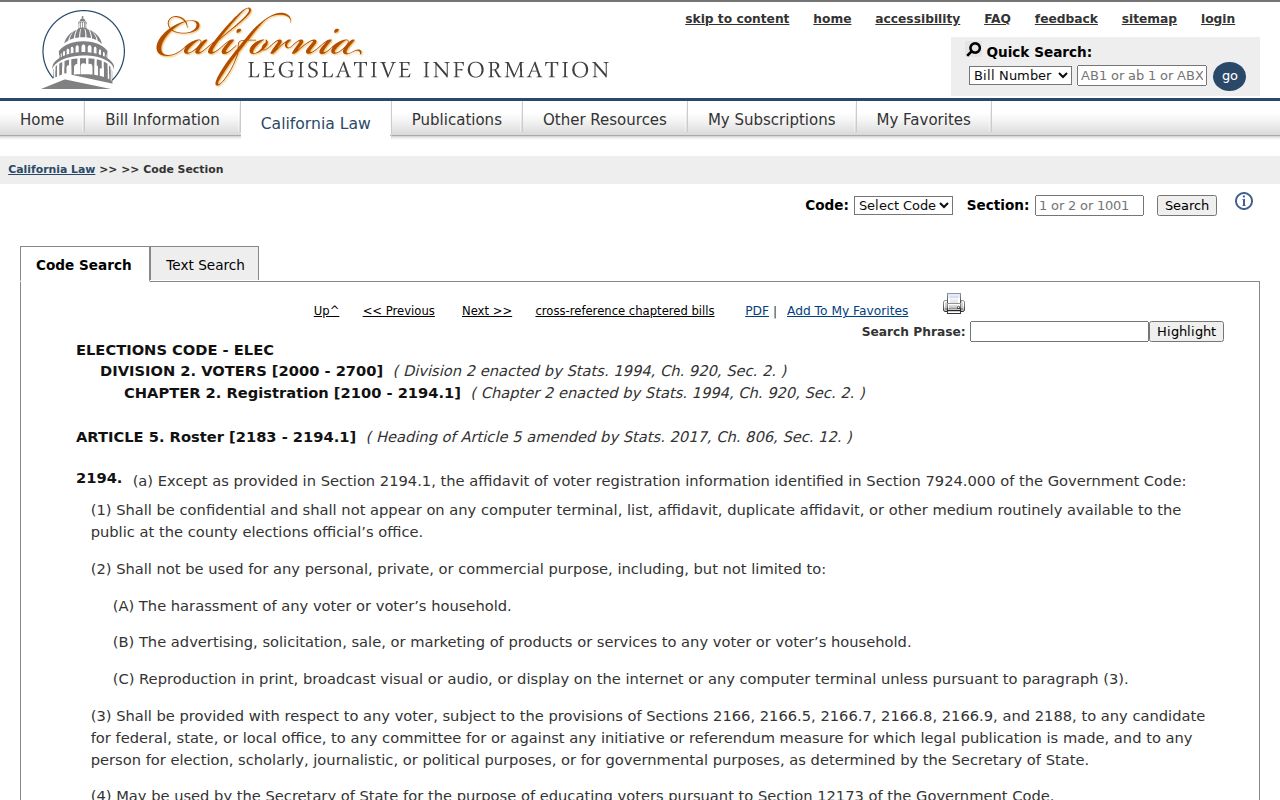
The statute image belongs with the use limit, not with a promise of ZIP-level names.
Definition box. These terms prevent false precision when a postal result is carried into a record search.
- ZIP
- A five-digit USPS delivery-area code. It describes routing, not a city polygon.
- ZIP+4
- Four added digits that narrow a five-digit ZIP to a more specific delivery segment.
- PO-box ZIP
- A ZIP used for a group of post-office boxes rather than a normal street-delivery area.
- Unique ZIP
- A ZIP assigned to one organization or institution, rather than a broad neighborhood.
- Carrier route
- A delivery path within a ZIP that groups addresses served by one carrier route.
Lake Forest ZIP Code History
Lake Forest's postal map makes more sense against its development eras. The land was part of Rancho Cañada de Los Alisos, then El Toro grew as an agricultural and rail-linked community. The modern city incorporated in 1991. Later master-planned growth around two man-made lakes and eucalyptus groves, postwar expansion tied to MCAS El Toro, and the 2000 annexation of Foothill Ranch and Portola Hills created different address histories under today's Lake Forest name.
Use the era that matches the record. A street in Baker Ranch, Serrano Summit, Portola Center, or Whisler Ridge may not appear in the 1931 Orange County directory or 1950 census geography. Search El Toro for pre-1991 references, keep Foothill Ranch and Portola Hills for pre-2000 annexation work, and use tract maps, legal descriptions, and APNs when a street or parcel changed. The historical term is not a rival to the ZIP result. It is the bridge that lets modern postal data meet older records.